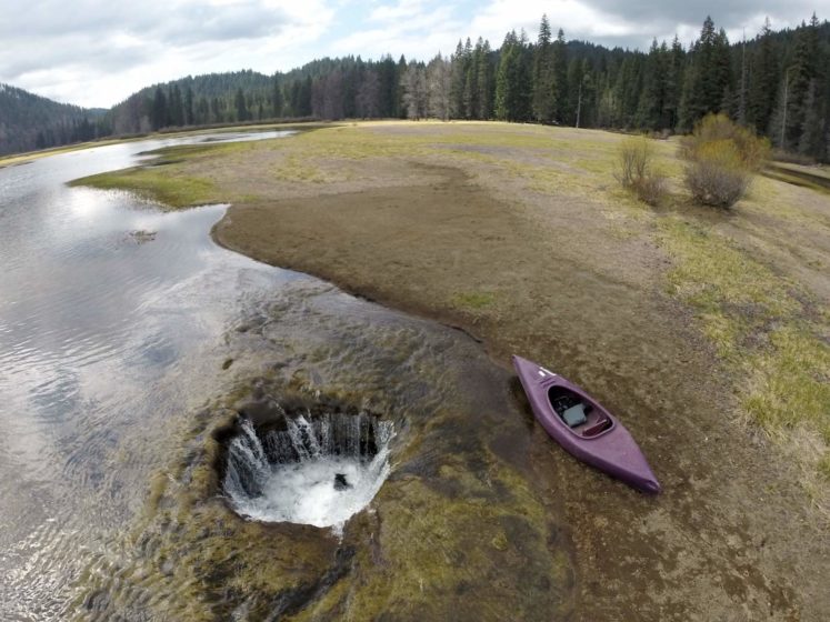
The Lost Lake is the source of a natural phenomenon that has Oregon residents stumped. When winter arrives, adjacent streams drain into the lake and cause it to fill with water. While this occurrence isn’t out of the ordinary, the lake does undergo a confusing transformation in the spring. As winter comes, the lake drains like one ginormous bathtub; the hole has always been there, the shallow lake surrounded by pine trees that sits near a highway.
As for its mysterious drainage, most likely caused by the region’s spongy volcanic landscape. This particular Lost Lake is located within the Willamette National Forest just outside the Mt. Jefferson Wilderness is one of the best known because it is easily accessible.
It lies adjacent to the heavily traveled Santiam Pass Highway, Oregon Highway 20. The lake is fed by three unnamed intermittent creeks from Lost Lake Butte, and Inlet Creek from Preachers Peak.
It is believed that Lost Lake’s opening is a lava tube that acts as a large drain. Unluckily, one precise question hasn’t been answered. The local people have been speculating about where the water goes after the lake is fully drained but no one has a clue.
It is believed, Lost Lake formed about 3,000 years ago when lava flowing from the Sand Mountain Line of small volcanoes blocked a river channel to create a small basin of water that now holds the lake. The lake bed begins to fill in the late fall when the amount of rain coming in starts exceeding the ability of the lava tubes to drain off the water. It continues to fill all winter long in a series of rain or snowstorms.
Therefore, when the rainy season peters out, the 9-foot-deep lake loses its water source, and water disappears down the lava tubes until it’s gone. The lake’s watery boom-and-bust cycle repeats itself every year. The lake contains many species of fish, i.e. brook trout, brown trout, kokanee salmon, rainbow trout, crayfish, otter, and beaver.
Throughout the area, you can find blacktail deer, squirrels, chipmunks, rabbits, black bears, cougars, and bobcats. The heavily forested area consists mostly of Douglas-fir and mountain hemlock with some cedar and white pine alder and huckleberry underbrush occurring in open areas.
However, it is not sure, where the drained lake water goes, but researchers have an idea. It likely falls down the lava tubes and seeps through layers of cracked volcanic rock as groundwater. Perhaps it may be absorbed into the porous terrain, though one thing’s for sure: the hole shouldn’t be plugged.
If anyone was ever successful at plugging it which we’re not sure if they could do it would just result in the lake flooding and the road. Hence, it is an important part of how the road was designed. More than a few small streams feed into the lake intermittently, but the lava tube drain holes are the only known outlets.
The Lost Lake’s water seeps into the earth and refills the underground water supply that feeds springs in other areas of the forest and even offers drinking water for the community. Further, it is projected that the lake’s water takes 7 to 10 years to filter down through all those cracks and pores before it ends up in someone’s glass. Though, not all people are respectful of the lava tubes.
Lost Lake is classified as mesotrophic, in contrast to numerous oligotrophic lakes in the High Cascades. The concentrations of major ions, alkalinity, conductivity, and pH are somewhat above average for Cascade Lakes.
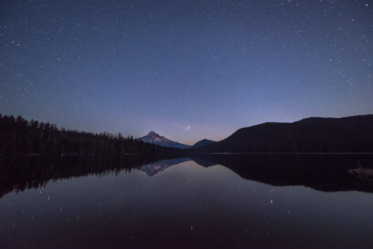
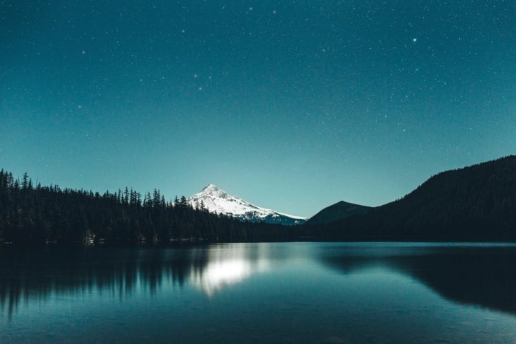
The water is adequately transparent that the bottom is visible everywhere, thus this combination of characteristics indicates mesotrophic but close to oligotrophy. The lake is also very popular with Photographers, Anything from landscape photography to wedding photography.
It is the most photographed lake in all of Oregon, as with some of the best views for Sunrises, Sunsets, And Astrophotography. The locals have been throwing trash garbage such as car parts, engines, and other debris in the hole. Apparently for fun or just to see if they can plug the hole. Throwing anything into the hole is strongly discouraged by forest officials as it could flood the lake and the road.
The Lost Lake is the source of a natural phenomenon that has Oregon residents stumped.When winter arrives, adjacent streams drain into the lake and cause it to fill with water.
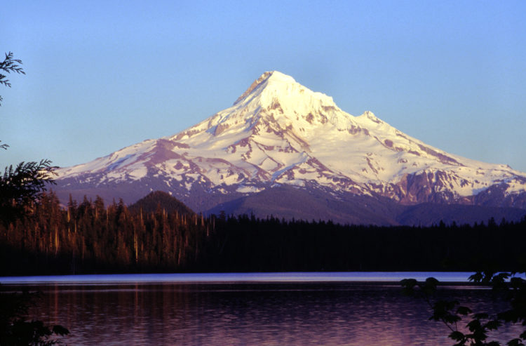
It lies adjacent to the heavily traveled Santiam Pass Highway, Oregon Highway 20. The lake is fed by three unnamed intermittent creeks from Lost Lake Butte, and Inlet Creek from Preachers Peak.Mount Hood as seen from Lost Lake, OregonThe lakebed begins to fill in the late fall, when the amount of rain coming in starts exceeding the ability of the lava tubes to drain off the water, and it continues to fill all winter.
This particular Lost Lake is located within the Willamette National Forest just outside the Mt. Jefferson Wilderness, is one of the best known because it is easily accessible.It is believed that Lost Lake’s opening is a lava tube that acts as a large drain. Unluckily, one precise question hasn’t been answered.The local people have been speculating about where the water goes after the lake is fully drained but no one has a clue.
It is believed, Lost Lake formed about 3,000 years ago when lava flowing from the Sand Mountain Line of small volcanoes blocked a river channel to create a small basin of water that now holds the lake.The lake’s watery boom-and-bust cycle repeats itself every year. The lake contains brook trout, brown trout, kokanee salmon, rainbow trout, crayfish, otter, and beaver.The Lost Lake’s water seeps into the earth and refills the underground water supply that feeds springs in other areas of the forest and even offers drinking water for the community.The heavily forested area consists mostly of Douglas-fir and mountain hemlock with some cedar and white pine alder and huckleberry underbrush occurring in open areas.