HomeAmazingKata Tjuta – A Group of Large Dome Formation in Central Australia
Kata Tjuta – A Group of Large Dome Formation in Central Australia
3417
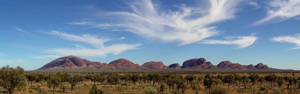
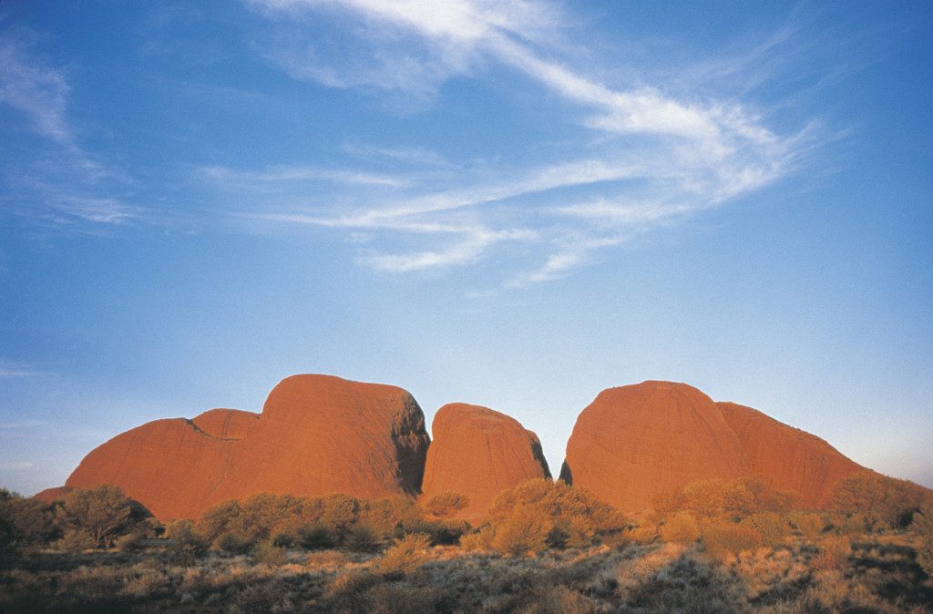
Kata Tjuta also called “Kata Joota”, and also famous as “Mount Olga” or colloquially as “The Olgas”. This is a group of large domed rock formations “bornhardts” cover an area of 21.68 km2 located about 365 kilometers southwest of Alice Springs, in the southern part of the Northern Territory, central Australia.
Both Uluru and Kata Tjuta / Mount Olga form are the two major landmarks within the Uluru-Kata Tjuta National Park. The majestically beautiful 36 domes that are made up of Kata Tjuta / Mount Olga are composed of conglomerate, a sedimentary rock containing cobbles and boulders of varying rock types as well as granite and basalt, cemented by a matrix of sandstone.
Moreover, the alternative name, “The Olgas”, comes from the tallest peak, Mt. Olga, which is, the highest point is 3,497 feet above sea level. In 1872, Mt. Olga was given the name by Ernest Giles in the honor of Queen Olga of Wurttemberg. On 15 December 1993, a dual naming policy was adopted that allowed official names both traditional Aboriginal names and English names. As a result, Mount Olga was renamed Mount Olga / Kata Tjuta. However, on 6 November 2002, the dual name was officially reversed to Kata Tjuta / Mount Olga.
The region organized an event known as the Woodroff Thrust, which thrust granulite facies rocks northward over low-grade metamorphic rocks. The ultimate erosion of the formation resulted in a molasse facies, or deposition in front of rising mountains, though in this case the Petermann Orogeny, to make the deposit recognized as the Mount Currie Conglomerate.
The Mount Currie Conglomerate is made up predominately of basalt, granite porphyry, gneiss, and volcanic rock fragments with a matrix composed of angular quartz, microcline, and orthoclase among other minerals. Anangu is the traditional owner of Uluru-Kata Tjuta and the land around and they have been at this place for an unidentified time.
Although Anangu people have been connected to the area for thousands of years and some historical records advise they may have been there for more than 10,000 years. They have always known that this is a very special place. There’s “Many Head” the huge rocks are separated by steep-sided gorges and valleys. Walking tracks lead around the area to lookouts, waterholes, and picnic areas, while the main trail, Valley of the Winds, is a 7.5-km loop.
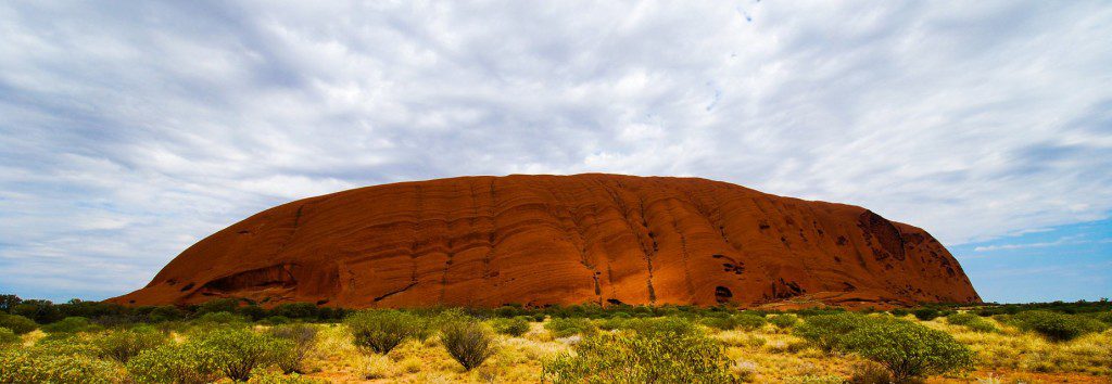
Uluru-Kata Tjuta National Park is the so-called Red Centre of the continent and is a UNESCO World Heritage area. Both Uluru “Ayers Rock” and the Kata Tjuta “Mount Olga” are made of sediment originating in this Mount Currie Conglomerate and both have a chemical composition like granite. Scientists predict the rock dating has been given an age of 600 mya, matching the date of the Woodroof Thrust event.
Therefore, the actual fresh rock that makes up the Kata Tjuta / Mount Olga and Uluru / Ayers Rock are medium to dark gray with green or pink hues in some laminae. The bright orange-red hue, for which the structures are noted, is due to a patina over finely divided feldspar coated in iron oxide.
There are several Pitjantjatjara Dreamtime legends accompanying this place and undeniably everything in the vicinity including, of course, Uluru / Ayers Rock. A vast number of legends surround the great snake king Wanambi who is said to live on the summit of Kata Tjuta / Mount Olga and only comes down during the dry season. The majority of mythology surrounding the site is not unveiled to outsiders, particularly to women.
As is the custom, should women become identified with the “men’s business” they are susceptible to violent attacks, even death. Kata Tjuta / Mount Olga can be accessed via Ayers Rock Airport. It is then a 55 km drive south, then west. Tourists have to pay the National Park entry fee. The park is protecting hundreds of plant species, 24 native mammal species, and 72 reptile species. To protect this, off-road access away from Uluru and Kata Tjuta is not allowed.
Kata Tjuta is most beautiful when viewed at sunrise or sunset. If you’re after some serious adventure, you can even grasp how incredibly ancient and strangely imposing Kata Tjuta is by tackling the moderately hard Valley of the Winds Walk. It is highly suggested to walk early in the morning as it makes a much more comfortable.
Therefore, if the climate is suitable for walks then visitors are allowed to walk, hence if the temperature is 36 degrees or more, then the walk is closed from 11 am at the Kalpa lookout. So, an early morning walk is best to avoid disappointment. If the temperature is due to be 36 degrees or more then this walk is closed from 11 am at the Kalpa Lookout, so get there early to avoid disappointment.
Another 2km walk that is available is the Olga Gorge Walk (Tatintjawiya), which walks into the beautiful gorge. The nearest accommodation to the Olgas would be at the Ayers Rock Resort, where there is a range of accommodations to suit all tastes and budgets. There’s a picnic and sunset-viewing area with its glorious, blood-red best at sunset.
Kata-Tjuta, one of Australia’s most spiritually and culturally significant landforms, lies 40 kilometers west of world-famous Uluru in the Northern Territory’s Uluru-Kata Tjuta National Park.


, Norfolk, England")
